Climate Change Solutions
California is suffering from climate change, but we are also a global leader in innovative and effective climate solutions.

Climate change is one of the greatest challenges of our generation. Extreme heat, flooding, drought, sea level rise and catastrophic wildfires: we are feeling the impacts all around the world, including in California. But our state is also an economic, political and cultural force for climate solutions.
The Nature Conservancy (TNC) in California works to equip our state with the science, tools and innovations needed to advocate on the world stage. We advance critical policies and frameworks that set clear goals and offer paths to achieve them. And we work on the ground to maximize nature’s role in carbon mitigation, community resilience and ecosystem protection.
While the United States withdrew from the Paris Agreement in 2025, TNC remains committed to honoring the Agreement goal. State and local leadership is more important than ever as we help the U.S. do its part. The world is watching, and the TNC California Climate Program believes we can lead the way in creating a brighter, climate resilient future.
TNC's Climate Plan for California
Nature can be a powerful force in the fight against climate change. We need to protect and restore nature at a transformative scale so it can do its job.
How we get there:
- Advance Nature-Based Solutions. Recover the ecosystems that sequester the most carbon, and change land use practices to protect communities and stop emissions.
- Make Energy Clean and Green. Accelerate California’s transition to a decarbonized economy by incorporating nature into energy planning, purchasing and permitting.
- Make Communities Climate Resilient for People and Wildlife. Plan development and drive policies that reconnect and prioritize nature and keep people out of harm's way.
Nature-Based Climate Solutions
People created the climate crisis, but we can also create the solution with a critical ally: nature.
Nature-based climate solutions are the ways we protect and restore the landscapes that nature has adapted over millions of years to sequester carbon and defend against climate impacts. Our lands could help us achieve a third of the greenhouse gas reductions needed to keep global warming under a catastrophic two degrees Celsius.
California Nature-Based Climate Solutions
-

28M
acres of California land suitable for natural climate solutions
-

514
million metric tons of carbon dioxide equivalent that can be reduced in California with nature
-

$27B
dollars in potential savings in using natural climate solutions to prevent climate-related damages
-

1/3
amount of needed emissions reductions that natural climate solutions can provide by 2030
We've done the science to show the importance of nature-based climate solutions across CA and are focusing on two key ecosystems—forests and wetlands—that have an outsized benefit to fighting climate change, protecting biodiversity, and helping people and wildlife adapt in a rapidly changing world.

Creating Pathways for Change
Our team works across the state to create the big-picture changes we need to truly leverage the impact of nature for climate. Collaboration with policy makers, community groups, private landowners, scientists, and many others is necessary to successfully transform California’s land protection and management practices. Current work includes:
Partnerships to foster collaboration between universities and government leaders in California and China to further joint research, dialogue and policy initiatives to leverage nature as a climate solution
Driving systems change through innovative policy and partnerships, including with the Federal Emergency Management Agency (FEMA), to increase funding and access to using nature as a disaster resilience strategy
- Reducing obstacles to restoration by reforming and streamlining permitting processes
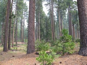
Healthy Forests for a Safer California
As megafires become more and more frequent, restoring California forests’ resilience to wildfire is a race against time. TNC is a leader in developing innovative solutions that meet the urgency and scale of this problem.
Luckily, we know how to keep our forests healthy and prepare them to withstand severe fires and other threats made worse by climate change. TNC and our partners throughout the West do this through ecological forest restoration, which often includes a combination of strategic thinning (meaning the removal of brush and small or unhealthy trees to reduce fuel for fires), and the application of beneficial fire as a follow-up or maintenance treatment.


Prescribed fire, cultural fire, and managed wildfire are recognized as critical components of the restoration of ecological health and resilience to California’s forests, but these practices can still be challenging to implement. TNC is working hard to scaling beneficial fire by:
Hosting prescribed fire trainings and events needed to increase the workforce of trained fire professions and to build a larger, more inclusive workforce.
Growing the public funding, personnel, and capital expenditures needed to plan and safely implement larger prescribed fires and more effectively manage wildfire behavior.
Developing policy solutions that address perceived risks of using beneficial fire as a land management tool, including state-backed claims fund and community wildfire insurance.
Project Highlights
-
After establishing the preserve in 2010, TNC launched our first forest restoration efforts on these 2,300-acres. To protect the lake’s threatened Lahontan cutthroat trout and reduce the risk of high-severity wildfire, we applied ecological thinning and prescribed burning techniques that are now being scaled across the Sierra.
-
In 2015, TNC brought together state, federal, and local partners—including the local water utility—for this first-of-its-kind collaboration. The group took the same restoration approach used at Independence Lake and scaled it in a 28,00-acre landscape (that’s 10-times larger).
-
Initiated in 2019, this 275,000-acre project will be the largest forest restoration of its kind in the Sierra. Using the partnership model we honed at French Meadows, we are working with nine partners to restore one of the most critical watersheds in the region.
-
Thanks to the scientific credibility and strong partnerships we built up through our work in the Sierra, TNC was invited to work with the U.S. Forest Service to lead the science effort that will guide restoration across the 2.4 million-acre band of forest surrounding Lake Tahoe.
Sustained Funding and Advocacy
With people throughout California focused on the growing risks and costs of wildfire, now is the time to promote visionary but achievable strategies to expand investment in wildlife resilience. That is why TNC is forming a new statewide coalition alongside our partners, Sierra Business Council and the Northern Sierra Partnership.
The Coalition for Wildfire Resilient Landscapes and Communities is organizing business groups, community organizations, local political representatives, firefighters, labor organizers, environmental justice leaders, public health advocates and others affected by wildfire to build the broad base of public support needed to increase public investment in wildfire resilience. The Coalition’s initial focus is to ensure that nature-based climate solutions, forest and wildfire resilience projects receive a significant proportion of cap-and-trade revenues during the program’s reauthorization in 2025—2026.
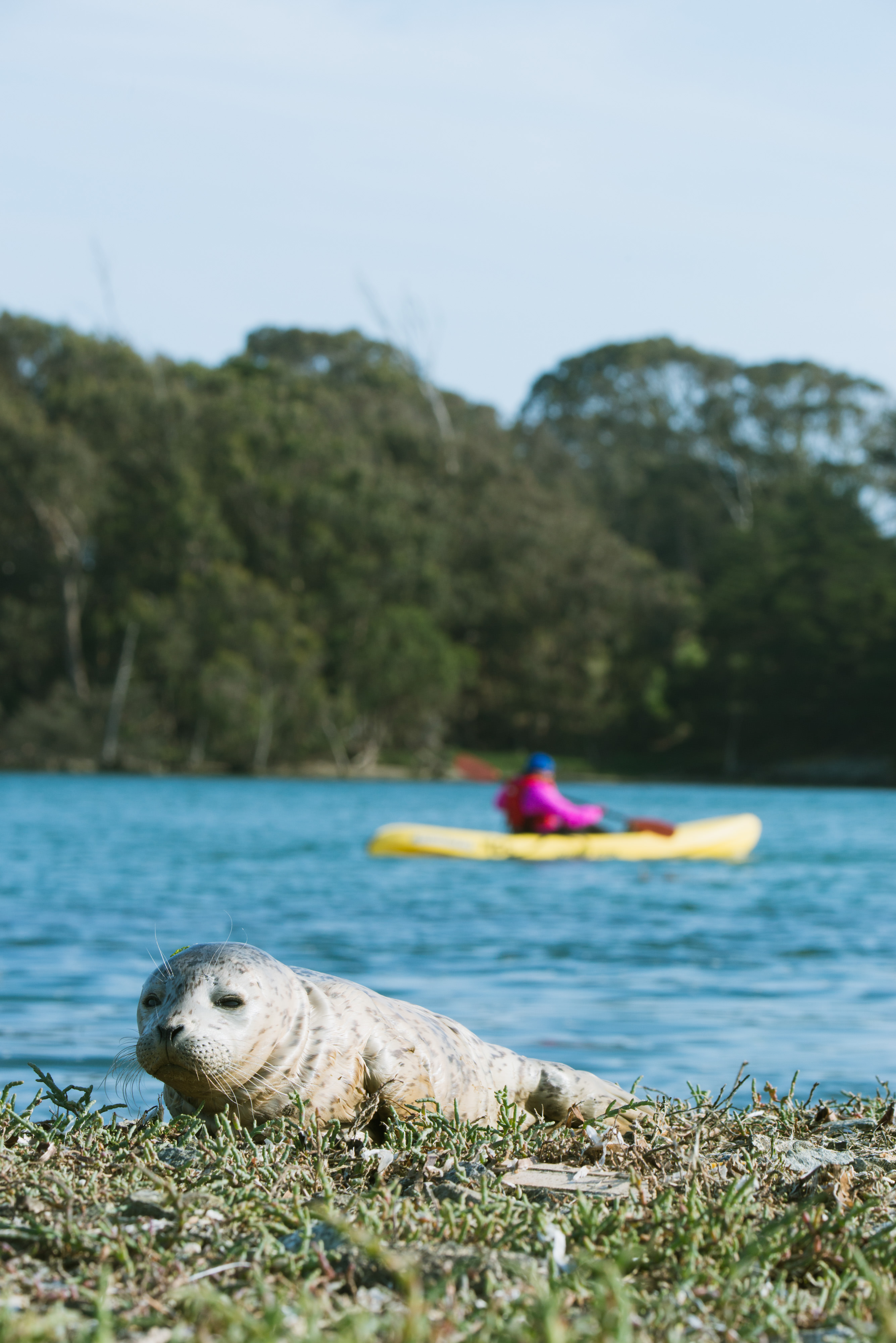
Wetlands: Iconic Wildlife, Incredible Protections
California’s wetlands play a critical role in mitigating the effects of climate change and are a vital part of our state’s natural systems. Benefits from wetlands include absorbing floodwaters and buffering against storms and sea-level rise, sequestering carbon, supplying critical habitat for native species, cleaning our water and more.


Sea-level Rise: Absorbing floodwaters and buffering against storms and sea-level rise © Aya Okawa /TNC Photo Contest 2019
Carbon : Sequestering carbon
Native Species: Supplying critical habitat for native species © Melinda Kelley
Water: Cleaning our water
Recreation: Offering opportunities for recreation
But our wetlands are in danger. While California has set these ambitious goals and has committed noteworthy funding resources, the pace and scale of protection and restoration are not keeping up with the need.

The Wetlands for Climate Partnership
We need a focused and coordinated effort among diverse partners to achieve California’s goals and protect our remaining wetlands. That’s why TNC, the San Francisco Estuary Institute (SFEI), The Pew Charitable Trusts, and partners have created the Wetlands for Climate Partnership to leverage complementary strengths in science, policy development, funding, community and practitioner involvement, and on-the-ground wetland conservation. The goal of the partnership is to break down existing barriers to accelerate wetland restoration and conservation. We will ensure more intentional, long-range planning and management efforts that benefit wildlife and people, especially those most vulnerable to climate impacts.
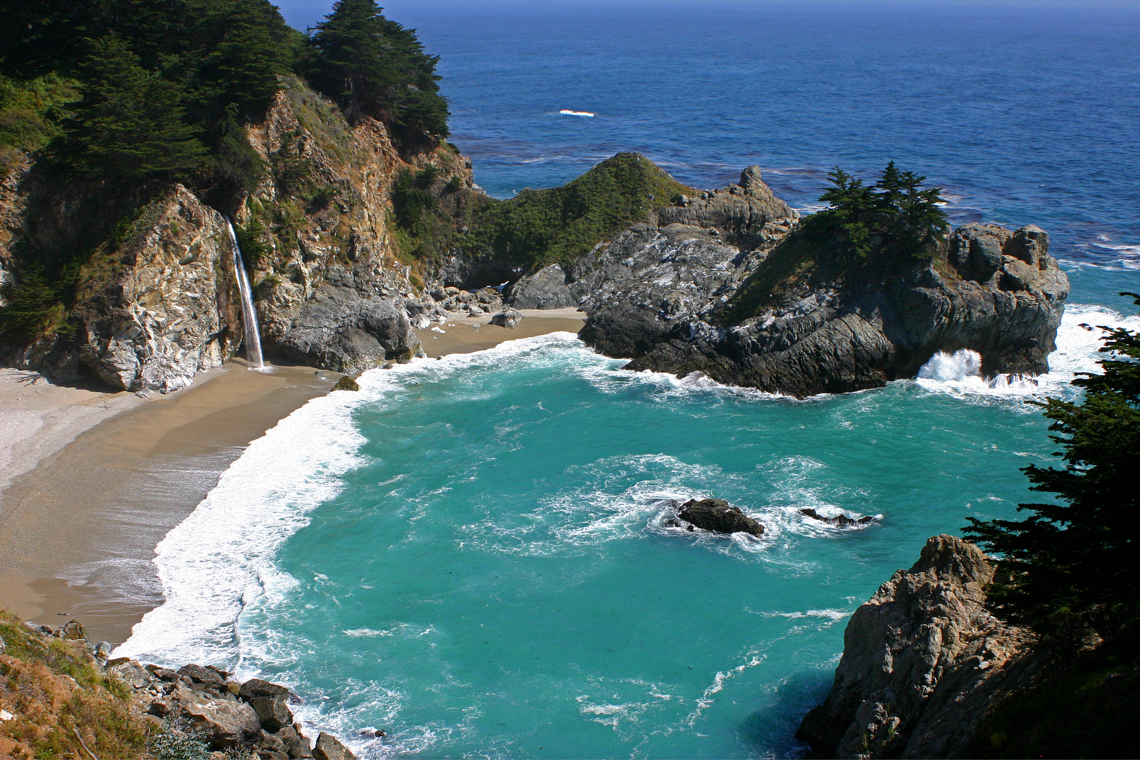
Fighting Sea Level Rise
The California coastline is a more than 3,000-mile-long treasure, one that is vital to our economy and home to an abundance of plants and animals, many of which exist only in California. With the Pacific Ocean projected to rise 5 feet in some coastal areas of California by 2100, we need to take action. If we want to protect what remains of our iconic coastline, we need to safeguard the coast of tomorrow.
The Future of Coastal Habitats
-

90%
of historic wetlands already lost to human land use
-

59%
of the area of California’s coastal habitats is highly vulnerable to 5 feet of sea-level rise
-

55,570
acres of coastal migration space statewide
-

61%
of losses can be mitigated by investing in future habitat
California’s natural and working lands have a role to play in addressing sea level rise. The Nature Conservancy and the California State Coastal Conservancy’s scientific study, Conserving California’s Coastal Habitat: A Legacy and a Future with Sea Level Rise, contains key strategies to protect our coast. One of these is to protect and restore future habitat as migration space, which also enhances the resilience of coastal areas to protect against the impacts of climate change.
Project Highlights
-
One of the greatest opportunities to conserve future habitat in California is the lower Pajaro River on the central coast. We’re working with partners to restore a recently acquired property at the Pajaro River Estuary, returning vulnerable agricultural lands to coastal marsh so they can better absorb floodwaters. This also provides habitat for native species, and we hope it can be a model for other coastal communities.
-
As much as 90 miles of scenic Highway 1 along California’s coastline is at risk of flooding from sea level rise and storms in less than one hundred years. In the vibrant Elkhorn Slough, flooding already impacts Highway 1, the Elkhorn railway, and the amazing coastal habitats and species that reside there. See these impacts brought to life with the Sea Level Rise Explorer.
In 2020, TNC co-led the first phase to evaluate and identify the transportation and ecological needs to increase the climate resiliency of the region. The Central Coast Highway 1 Climate Resiliency Study explored how transportation infrastructure can be adapted to benefit nature and transportation, detailing how cooperative planning between sectors can improve outcomes for both. Working with transportation, environmental, and community leaders, we are now working to move forward nature-based designs for the transportation corridor and ambitious tidal restoration of the slough’s marshes.
-
Ormond Beach: Protecting and restoring Ventura’s future coastline through a community vision. [Additional information needed.]
Resilient Delta: Carbon Farming at Staten Island
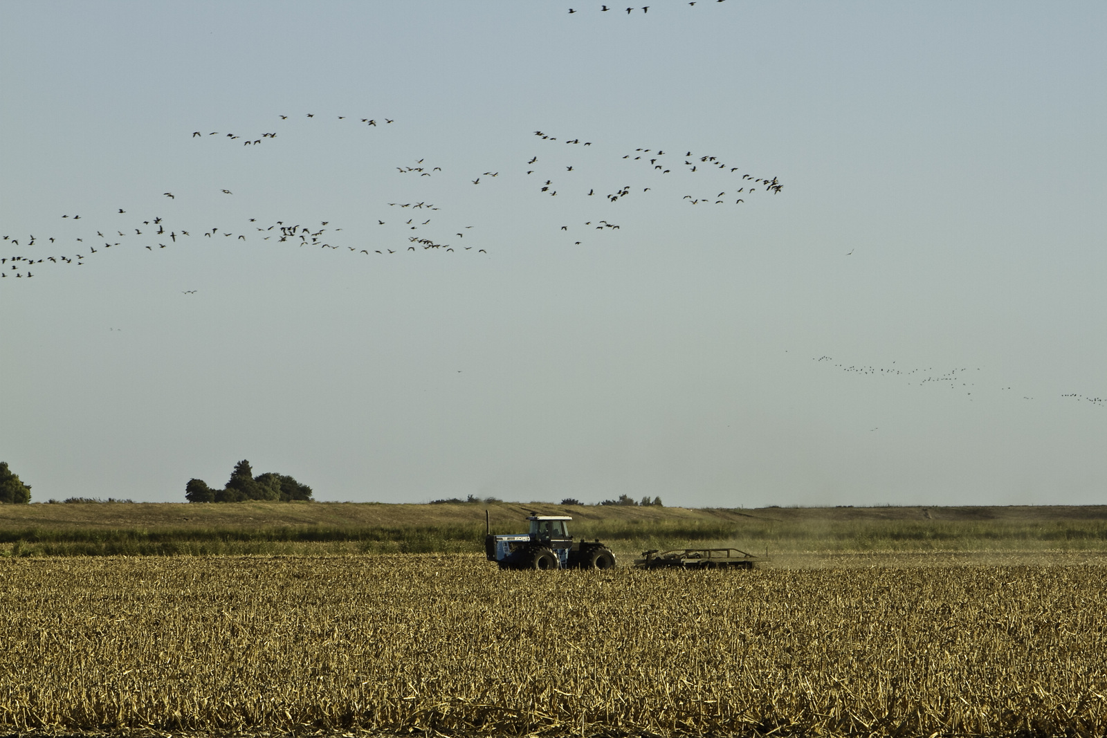
With its rich peat soil and more than 750 species of plants and animals, the Sacramento San Joaquin Delta is vital in maintaining California’s vibrant biodiversity and is a major provider of water for people and agriculture alike. But human impacts and climate change are threatening the Delta.
Science shows that there is a path forward. Cultivating native wetlands and changing agricultural land management practices, such as converting corn crops to rice, lead to reduced GHG emissions, increased carbon sequestration, reduced subsidence, and improved peat soils. These solutions, often referred to as carbon farming, provide a climate and habitat-smart strategy to restore the Delta and maintain the vital services it provides to California.
SECURING THE DELTA’S FUTURE
Climate-smart land management and carbon farming can play a powerful role in the Delta. TNC and related company Conservation Farms and Ranches (CF&R) are putting this into practice by:
Using a mosaic approach to farming by cultivating rice and other crops as we restore adjacent wetlands. By the year 2058, this mosaic operation will provide an estimated cumulative reduction in GHG emissions of up to 549,000 metric tons of CO2 Equivalents.
Restoring 1,00 acres of wetlands to further reduce GHG emissions, in a process that also leads to improved peat soil and provides climate benefits.
Providing critical habitat for migratory waterbirds through BirdReturns, which pays California growers and wetland managers to transform their lands into temporary habitat.
A New Urban Wetland for L.A.
In the coming years, billions of dollars will be invested to upgrade infrastructure and address climate change in cities and other urban environments. We have the opportunity to bring nature into this effort and we’re demonstrating the benefits of urban conservation in Los Angeles. With the Bowtie Wetland Demonstration Project, we aspire to create a highly visible new model for urban restoration where habitat, water treatment, public access and climate resilience combine in one place to demonstrate what the future of the L.A. River and surrounding region could be.
Unlocking Clean and Green Energy
Accelerating the energy transition to renewables, such as solar and wind, must happen to ensure a livable climate future. However, rapid development of solar and wind energy projects requires massive amounts of land and can negatively impact nature, and conflicts over land use can significantly delay renewable energy development. The transition to clean energy needs land-use solutions. This is why TNC applies our science and land use expertise to advance clean and green energy: energy that is zero carbon and located in areas of low-impact to nature.
TNC is actively applying our science and tools to strategic planning, decision-making, and energy development across California. Our goal: to ensure that the renewable energy transition prioritizes conservation, climate and communities.
We’re working to make this goal a reality by planning for California’s clean energy future; developing research and science to support deploying clean and green energy; and advancing policy to enable an electric grid that is clean, reliable, and resilient to the challenges of extreme events driven by climate change.
Through our work in planning, research and policy, TNC is helping catalyze a rapid renewable energy buildout that safeguards nature and supports an equitable transition for communities.
Project Highlights
-
In 2019, TNC published a first-of-its-kind study for California, Power of Place, a report that integrates sophisticated energy modeling with conservation data to demonstrate how the state can achieve its clean energy goals while limiting harm to vulnerable ecosystems and factoring in cost and electricity reliability. Since then, TNC has replicated the methodology to show how we can decarbonize in ways that minimize impacts to nature across the western United States and nationwide. TNC also led an analysis to identify transmission investments needed to enable low-impact solar development in the San Joaquin Valley, a critical area for advancing the Power of Place-West’s vision.
-
The Mojave Desert plays a leading role in California’s ambitious renewable energy goals. Wind and solar energy installations are becoming an increasingly common sight in the desert. While those projects make important contributions to California’s climate change objectives, they need to be pursued in places and ways that will allow California’s natural habitats to continue thriving.
TNC’s Development by Design brings together everyone who depends on the region’s resources in order to ensure a permanent and amicable solution to the desert’s environmental and energy needs. By using TNC’s extensive scientific knowledge of the region, we can guide the development process and inform mitigation strategies to make the Mojave a healthier place.
-
Batteries are a key part of society’s plan to decarbonize, which depend on lithium. So TNC recently led and published one of the first studies in the country considering potential impacts from critical mineral mining focused on lithium extraction. With information about potential impacts to water, habitat and wildlife—and approaches to minimize these impacts—policymakers and community leaders have new information to navigate this growing challenge.
-
TNC’s Green Light Study showed that clean and green energy projects in California were permitted 2.5 times faster than clean energy projects proposed on ecologically important land. Through proactive planning that incorporates land and conservation data into energy decisions, California can significantly ramp up renewables and minimize delays while also limiting negative impacts to the natural and working lands.
-
Over the last decade, TNC has been an active supporter of California’s SB 100 with a goal to achieve 100% renewable and zero carbon energy by 2045. California is currently updating the roadmap to achieve this vision, and TNC is bringing our science to these discussions to show how we can achieve multiple goals together, including protecting nature and maximizing reliability and affordability.
As California leads the nation in transitioning to a zero-carbon economy, we also have an opportunity to further leverage TNC’s work. The tools and approaches that we are developing and deploying here in California are being adopted far beyond our borders, across North America and the globe.


Building Resilient Communities
California lost over one million acres of natural areas from 2001 to 2017 alone, primarily due to the outward expansions of cities, suburbs, and exurbs. Urban sprawl like this also creates carbon emissions and puts people directly in the way of climate-exacerbated natural disasters like flooding and wildfires. There is a better way to grow our communities, and it means prioritizing nature in community planning so we can avoid impacts to nature, reduce greenhouse gas emissions and improve climate resilience for people and all living things that call California home.


Curbing Sprawl
Building on over 60-years of leadership in California, TNC creates and leverages existing policies, data, and tools to elevate the role of nature in planning and designing communities. We use our scientific expertise; connections with local communities, partners, and policymakers; and a long history of influencing land to incentivize land use to facilitate incorporating nature—and nature’s benefits—into development plans. Projects include:
- Incentivizing climate-smart housing in existing communities and disincentivizing housing in places that fragment key habitat, put people in harm’s way, and contribute to urban sprawl.
- Creating the Greenprint Resources Hub, a web-based tool to identify, map, and measure the values that natural resources contribute to the ecosystem, the economy, and the local and regional community.
- Developing frameworks for multiple types of conservation plans to maximize the benefits of conservation investments for nature and reduce costs and risks to infrastructure projects.
Creating Wildlife Corridors and Crossings
Habitats across California are increasingly fragmented, putting wildlife at risk and preventing nature from being able to function fully. TNC is implementing an ambitious suite of connectivity projects to protect connected landscapes and reconnect wildlife corridors.
Project Highlights
-
TNC and partners are convening this landmark event is part of our efforts to create a vision for a system of connected landscapes and network of wildlife corridors at the regional and statewide scales, and working in coalitions of partners to advance policies, create funding streams and drive implementation to make the vision a reality.
-
TNC is protecting wildlife corridors and building wildlife crossings projects, including over and under the I-15 in Riverside County, to allow wildlife to safely move.
-
Policy changes are essential in order to drive larger scale, robust conservation investments to secure essential, connected landscapes before they are lost to conversion.
-
TNC is creating networks for nature by connecting habitats to help California wildlife survive the climate crisis.

Destination Nature: A Path for Mountain Lions
Click the green arrow below to hear episode two of Destination Nature.
Stacy Raine [SR]: Late one night, a lone mountain lion walks silently toward a concrete bridge and eyes the creek path underneath. He’s known to the researchers that collared and track him as M93. He’s a young lion – just two years old. Until recently he’d been with his mom, learning how to survive. Now, it’s time to establish his territory somewhere else.
In the last six weeks he’s covered the roughly 60 miles from the top of the Santa Ana mountains in Southern California down to the bottom. He’s ventured farther south, into the mountains of Camp Pendleton, the expansive military base just below. Then he kept moving, making his way over to the rapidly developing outskirts of Temecula, one of southern California’s fastest growing cities.
He wants to go under that bridge, to follow Temecula creek, the natural migration path for animals in this area. He wants to get to the other side, where he can more easily find territory and suitable mates.
But there’s one big 8-laned problem holding him back.
This is Destination Nature, a podcast by The Nature Conservancy that takes you into the field to
hear the stories behind conservation projects from all around the globe.
I'm Stacy Raine.
Interstate 15 begins in San Diego, and if you drive about an hour north along this road, you'll find yourself in the city of Temecula. On this stretch of the 15, you’ll probably notice how many rocks dot the green vegetation of the Santa Ana mountains off to the west. Some jut out so far, they look like they might come tumbling down at any moment. Off to the east, past the golf course, you can see the looming peeks of the Palomar Mountain range.
What you probably won’t notice as you drive on this busy highway is that Interstate 15 cuts right through the only natural migration corridor for mountain lions in this area.
This is a big problem for M93. This highway roars with traffic. It’s no place for this lion, and he knows it.
Winston Vickers [WV] We've had mountain lions that had radio collars, so we knew exactly where they walk, uh, come down, there's creek for instance, and come within about 60 yards of the bridge and then turn around.
SR: Dr. Winston Vickers is a research veterinarian with the Wildlife Health Center at UC Davis. He and Trish Smith, an Ecologist for The Nature Conservancy, have been working together for many years to study mountain lions in this area to understand the threats they are facing.
Tracking collars make the job a little easier. There’s really only one way to put a collar on a mountain lion. You have to capture him, help him go to sleep, put your hands uncomfortably close to his face, and secure the collar around his neck as carefully as you can. Common practice for Winston. He places roadkill deer in places that, thanks to trail cams, they know mountain lions frequent, and when a lion enters the trap:
WV: We would go immediately to that location and sedate them, uh, with anesthetics and put collars on them, sample their blood, sample, their tissue, their hair, their whiskers, all kinds of samples to learn as much as we could from each handling event with the mountain lions.
SR: It’s exhilarating and rewarding work, but it can also be a little unpredictable.
WV: I have had one just to suddenly stand up with us right beside it on our knees. And then he was eye level with us. But, uh, of course what he wanted to do was leave. And so, we just, I just sort of grabbed his, he had his radio collar on, so I just kind of grabbed him and directed him away from us and he left cause that's what he wanted to do. Um, you know, when they wake up, suddenly they're very confused and you know, they're groggy. So, it's not like there's a great deal of danger there, but, but it can be disconcerting.
SR: Disconcerting at times, but worth it because they’ve learned quite a bit from tracking these lions.
WV: They're migrating animals that are looking for homes and they're very compelled to explore and keep going. Their ranges are large. An average home range of a male is around 150 square miles in this area and females about half of that. And if you think about 150 square miles in an area like this, you cannot cover that much ground without crossing a highway or two or three. So just to maintain a territory, they have to be crossing highways and that's why a highway like I 15 tends to divide territories
SR: M93 has reached this juncture that leads under the interstate for a reason. It’s the path that will take him from the Santa Ana mountains to the Palomar Mountain Range. He needs to pass through – he’s driven by instinct to migrate, maybe away from other males, maybe due to hunger, and so far, he hasn’t been successful finding a place of his own.
M93 is pinched, as these scientists say, into this part of the mountains due in large part to development, and specifically to the interstate that cuts through the normal migration corridor for mountain lions and other species as well.
What was once one large population of mountain lions spanning across California has now been divided into ten, all becoming genetically different from each other. Six of those subpopulations are in the coastal California area south of San Francisco and all of them are experiencing a loss in genetic diversity to some degree.
WV: This population is the most inbred population anywhere on the globe, actually, of mountain lions except uh, the Florida panthers and they are an endangered subgroup of mountain lions, in the Everglades. And the Florida panthers went into this extinction spiral as they say, or extinction vortex is a term that used. And so, what we're trying to avoid is the same thing happening here and the population beginning to decline dramatically.
And other than them, this is the most endangered population from the standpoint of, of the effects of inbreeding.
SR: In cases like this, where a population is cut off from opportunities to mate with other populations, they experience what’s called “inbreeding depression.”
WV: This is a term that's applied when kittens don't have as good a survival rate. There are sperm abnormalities in the males. The females may have less fertility, so you have a net effect of fewer kittens per female per year. Uh, and so over time, naturally a population declines if there's no new animals coming in to replace that, that lack of reproduction.
This sub-population of lions in the Santa Anas, this one group that used to be part of a whole population that mixed genes across California, is suffering from reproductive losses so great that they can’t sustain their population over time.
SR: At the bridge along Temecula Creek, M93 hears the traffic, he sees the cars, the lights. He weighs his options.
WV: They tend to approach highways like this one and then turn around. In many cases they rarely try to cross even when structures are present, where they could safely cross. If the highway is super busy.
SR: M93 senses that crossing could be deadly, but the decision not to cross is just as deadly for these animals. Not crossing means the entire population here in the Santa Ana mountains could go extinct by 2050.
It’s very rare to see a mountain lion in the wild, but it does happen on occasion. Trish, TNC’s Ecologist on this project, said she’s spent a lot of time in the field and:
Trish Smith [TS]: In my 30 years of being a biologist. I've seen a mountain lion; I think 11 times in the wild.
They're very elusive. I sensed their presence before I actually saw them. Most times they're either behind a rock or up in the brush or I just kind of look to the side and there they were. And then they take off like lightning. They're just gone. As soon as you see them, they leave. You don't even hear them. Um, even when they're running away.
SR: It’s surprising they are so quiet considering their impressive size. As adults, these felines are usually 6 to 8 feet long from their nose to the tip of their tail. Females can weigh around 85 pounds and males are even larger at 150 pounds.
WV: They're front paws are a little bigger and a big male will have a paw, if his claws are extended, the size of a man's hand. So very, very big powerful instruments.
They have powerful, slightly longer rear legs so that they're good at ambushing and jumping. They can jump long distances and, and jump 12 feet in the air, uh, to clear fence
SR: These majestic animals are known by more than 80 different names – so many, in fact, that one of its nicknames is “cat of many names”:
WV: Cougar, Puma, Catamount and panther in the case of Florida, but in South America, central and South America, they have a number of other Spanish-derived names.
SR: They’re also known as ghost cats and mountain screamers, and if you’ve ever heard the blood-curdling vocalization of a female mountain lion, you know why those names are so fitting.
WV: They don't roar. Uh, they don't have that capacity.
They, uh, do something of a scream, uh, at times that people have likened to a, a woman's screaming. That's primarily, uh, females in heat. When their advertising their status, they purr, usually females interacting with the kittens they chirp the females, uh, and the young oftentimes chirping each other like birds and they sound like birds.
They growl.
SR: But as M93 walks towards the Temecula Creek Bridge he probably isn’t making any noise at all. He is looking, listening, smelling, wondering if he should try and cross. He doesn’t.
The thing is, the path along Temecula Creek that leads under that interstate is actually a safe place for him to move through. The bridge is located right next to protected lands in the Santa Margarita Ecological Reserve managed by San Diego State University. The other side is protected by Riverside county. He could make it through and work his way to the Palomar mountains. He just doesn’t know it.
Cara Lacey [CL]: It's a functional wildlife crossing, but it's not functioning to the point where it should be.
SR: That’s Cara Lacey, an urban planner for TNC. She thinks about how we can better plan our use of land in a way that helps protect wildlife, and one place she thinks a lot about is this bridge.
She says there are so many deterrents that mountain lions and other species aren’t using it like they could be.
There is, of course, the problem of seeing moving vehicles. The cars zooming above, the headlights streaking past. There are also overgrown, invasive plants blocking M93s line of sight. He can’t see to the other side, and studies show that without knowing they can safely cross, mountain lions usually won’t even try. And, a lot of times, people are there, partying, camping, drawing graffiti under the bridge.
If that isn't enough to deter this lion, the traffic sounds that are magnified by the bridge structure itself probably do the trick.
CL: That's just constant. It's sharp noises. It's rumbling noises.
WV: So, there are things about the environment that they tend to, to have almost like an invisible barrier.
SR: So, mountain lions end up trying to cross the interstate in places nearby, and it’s not going well for them. There are not very many mountain lions here as it is. Winston estimated that there’s maybe 5 or 6 males and 11 or 12 females in the Santa Ana Mountains. Less than 20 adults, then add in a few kittens and some adolescents as well. If we’re lucky – 30 in all. Not very many, and Certainly not a large enough gene pool to keep this population healthy. They need to make connections with other groups of mountain lions.
So, these big cats are motivated to find somewhere else to roam and find mates. If the bridge doesn’t seem like a safe place, and if they are very bold, they chance Interstate 15. And a very few times, they’ve made it across.
WV: Of the animals that we have identified that did come into the mountain range, which is only three over the time of the study, um, only one survived and reproduced that we detected. Young mountain lions don't live very well anyway. They have to compete with adults. They have to cross strange territory that they don't know. Uh, they have to cross roads that they're not familiar with, so they don't know where the safe points are. So, they have a lot of barriers just getting around the landscape as new individuals, like going into a new neighborhood and they're trying to find their way around where they can run into hazards.
SR: Three made it over to the Palomar mountains, one survived. That was over the course of the study he is referring to, the Southern California Mountain Lion study. It’s been going on for nearly 18 years.
The situation is dire. They could go extinct in as little as 12 years.
But why does this matter? What’s the big deal with these big cats?
WV: All the large predators have major ecological roles of regulating ecosystems. The mountain lions help regulate the coyotes and the smaller carnivores. And if they're not there, they tend to - those animals tend to increase in numbers and that can have an impact, a negative impact on ground nesting birds and, and other wildlife. And then if they're not regulating the deer, the deer can have an over abundant impact on the vegetation. And that can change the ecosystem in a broad way. And that's been documented in multiple ecosystems with multiple large top predators that when the top predators are removed, then those animals below them on the food chain tend to increase in number and it alters the entire ecosystem.
SR: What we see happening to the largest predators in an environment means that the smaller ones are suffering too. It’s not just the mountain lions that are getting pinched into this area and can’t cross the road.
CL: The mountain lion is a really great indicator of the issues that most species are, are experiencing right now with additional roadways, additional, um, highways and freeways as well as additional housing encroaching into their environment.
SR: Of course, there’s also protecting nature for nature’s sake. But even more surprisingly, they play an important role for people:
WV: It’s even been shown that with mountain lions and deer, if deer numbers increase, then, uh, collisions with cars increase.
SR: And they keep a check on some of the species we also don’t want too close, especially in our homes, like rats, for one.
TS: With these Mezze predators like raccoons, skunks, possums, they aren't particularly popular in our neighborhoods. And when their populations get out of whack because there's no longer larger predators like coyotes, you'll really see even more cascading effects in terms of an outburst of rats, which then become a problem in people's yards and in people's homes. So, by keeping the balance of predators, whether it's mountain lions, coyotes, and the smaller predators, we can really keep a healthy ecological system, not only for nature but for people as well.
SR: Inbreeding due to severed migration corridors isn’t the only threat to these lions. Mountain lion territory is shrinking under pressures from development, bringing us closer and closer to the places they frequent, and forcing them to come closer and closer to us in search of food or territory.
CL: We're seeing both the barriers of highways, but also the increased urbanization that's impacting their, their movement and, and how they're, they're able to live and survive.
SR: And particularly, there’s a problem with the way we’ve developed. We’ve fragmented the landscape. We’ve put a subdivision over here, a shopping center over there. As Winston put it, we’ve essentially just created “more edges,” making it much harder for mountain lions to avoid their biggest predator – Us.
When a mountain lion snatches a pet, which happens occasionally, or kills someone’s livestock – which happens more frequently, the owner can seek a permit to kill the lion. People want to protect their animals, the mountain lions want to get their next meal, and the resulting conflict is bad for the people and their animals and can be deadly for the lions.
WV: The more narrow you put the spaces between the, the areas of urbanization, the more likely they are to move into urban area as they're trying to find their way through.
SR: M93’s story is not a happy ending. The night he turned away from the bridge was in 2012, and he never did cross to the other side, though he went back to the interstate several times. Two years later, he was poisoned.
His family’s story isn’t much better. His mom, F89, was killed by a male lion, perhaps while protecting her offspring. His brother, M91, was killed on a toll road during their journey together early on. His half-brother, M118, the one F89 might have died trying to protect, was legally killed for threatening livestock.
Before M93 died, though, he’d established a territory and fathered at least two kittens. One of his descendants, M122, was later killed after also taking someone’s livestock. We don’t know what became of the other one.
TNC is working hard to save these lions, bringing together partners to find ways to help them migrate safely both in the short-term and in the long-term.
Ideally, we’d create a “system of crossings” as these scientists put it, giving species several safe routes to pass over or under the interstate. Different species want to migrate in different ways. Trish puts it pretty simply:
TS: You won't catch a butterfly going through a culvert or an underpass of a freeway. An overpass would probably work better also for our lizards as well.
To determine exactly the best way to create safe passages for wildlife in the Santa Ana Mountains, TNC and our partners consulted with wildlife crossing experts. We also brought in the state's highway agency, Caltrans, that owns and manages the highways and would undertake the building of any structure. Then UC Davis, funded through a grant from the State of California, brought in civil engineering students from California Polytechnic University Pomona to illustrate what these crossings could look like.
CL: Cal Poly looked at three different conceptual designs and feasibility studies and the three designs were one to upgrade the Temecula Creek Bridge. The other was to look at a culvert that could be, um, kind of bored underneath the freeway under I 15 to reconnect the habitat there. And they also designed an overpass and it would span over the entire freeway, um, with a central support.
SR: Cara and Trish are particularly excited about this overpass, which could be as wide as a football field. There’s one big difference between regular bridges made for people and this design made for wildlife:
TS: It would be vegetated. So, you would have soil actually on top of the bridge. It wouldn't be a roadway bridge that used is used by cars. It would be solely for wildlife use and so we would place a layer of soil on top, they say like three meters of soil on top of which you would plant native chaparral habitat or coastal sage scrub habitat, the habitat that's found on either side of the roadway so that wildlife that are approaching the bridge, just see it as another patch of habitat they're moving through.
SR: It would stretch right over those 8-lanes of interstate, starting on SDSU’s Santa Margarita Ecological Reserve – but there also needs to be a protected space on the other side that’s safe for mountain lions.
This is where a recent TNC land purchase comes into play. You can build 5, 10, 15 crossings, but if the land around the crossing isn’t protected, they will be obsolete as soon as development takes up the open space. TNC was keenly aware of this and found the perfect spot to purchase and set the stage for future wildlife crossings - right across the interstate from the Ecological Reserve
TS: Rainbow Canyon property is just 73 acres, but it's pretty representative of the Santa Anna Mountains in this particular region.
SR: By that she means that it stays green and has dense, shorter vegetation. It’s very rocky, has a few rare plant species including Rainbow Manzanita, and wildlife like birds, foxes, bobcats, and of course, mountain lions.
But getting the permits in place and constructing these two new passageways – the culvert and the overpass – will take decades, and that’s after the funding is in place to do it. But time is something these mountain lions don’t have.
TS: Temecula creek is the only natural corridor that we have now that's linking the Santa Anna mountains eastward to the eastern peninsula ranges. And so, because it's the only viable crossing we have, we need to figure out how to fix it. And that's where ideas of enhancing the habitat, dealing with the roadway noise by putting in sound buffers underside, the a bridge overpass might be measures that will enhance its function for not just mountain lion spot, all sorts of wildlife species.
SR: The current deterrents there – vegetation overgrowth, lighting, noise, even people - these things are relatively easy fixes, ones that might take only two or three years.
We need to fix that bridge, and make sure the animals still aren’t trying to cross elsewhere.
WV: We would like to prevent them from even trying it with fencing. The hope is that they will move alongside the fence to the good crossing and cross there. Just having a crossing doesn't do it.
SR: Longer term, the culvert and the overpass structures can be built to give mountain lions and other species safe places to cross that work for them. Some species want to stay in open air, some are happy to go underneath. There’s a real need for both, in addition to the upgraded bridge path.
CL: Of course, in an ideal world, we could have all three. Um, and we'd fund all three and we'd have the ability to build all three,
SR: These crossings, once completed, and the land protection around them, will reconnect habitat and species here. The hope is that this serves as a model, encouraging new crossings and habitat protection elsewhere in the state and even further afield. That eventually all these populations will no longer be cut off from each other – they’ll have clear migration routes that keep them healthy and encourage them to move in places not so close to human habitat.
If this work can be done – if crossings are built and the right land is protected, the future is bright for wildlife here. They can finally – easily, safely – cross that interstate.
CL: There's no more deaths, there's no more impacts to animals. They have the ability to finally cross and to find each other. Um, in terms of the mountain lion. And so, you'll start to see more genetic diversity, which is really what we need to have for the mountain lion. But that's also an indication of what can happen for other species.
So ideally, we would want to see generation after generation start teaching their young how to use these crossings instead of trying to cross the freeway. Of course, we'll have wildlife fencing, but they'll know how to follow that and get to the crossings that they need to use. Once you get, a species starting to cross they have the ability to teach their young how to use it. And seeing that happen is really, really impressive.
SR: It’s possible that, one day, maybe a descendant of M93’s kitten, the one that we hope is still somewhere out in the Santa Ana mountains, will be led across this overpass by his mother, led through this new landscape over the roaring interstate, this place just for them that will lead them safely to the other side.
Thanks to Winston Vickers, Trish Smith, and Cara Lacey for being on this show.
Destination Nature was produced by Katie Bacon, Amy Hepler Welch, and me, Stacy Raine with help from Kristin Mullen. Special thanks to AudioRaiders for the production sound, Bradley Morgan Dale for the music, UC Davis for some of the sounds, and the Dallas Audio Post for their editing work on this show. But most importantly, we are so grateful to our supporters who made this work, and this story about the work, possible.
Next time on Destination Nature, take a trip to Philadelphia to see how nature is helping this historic city fight water pollution.
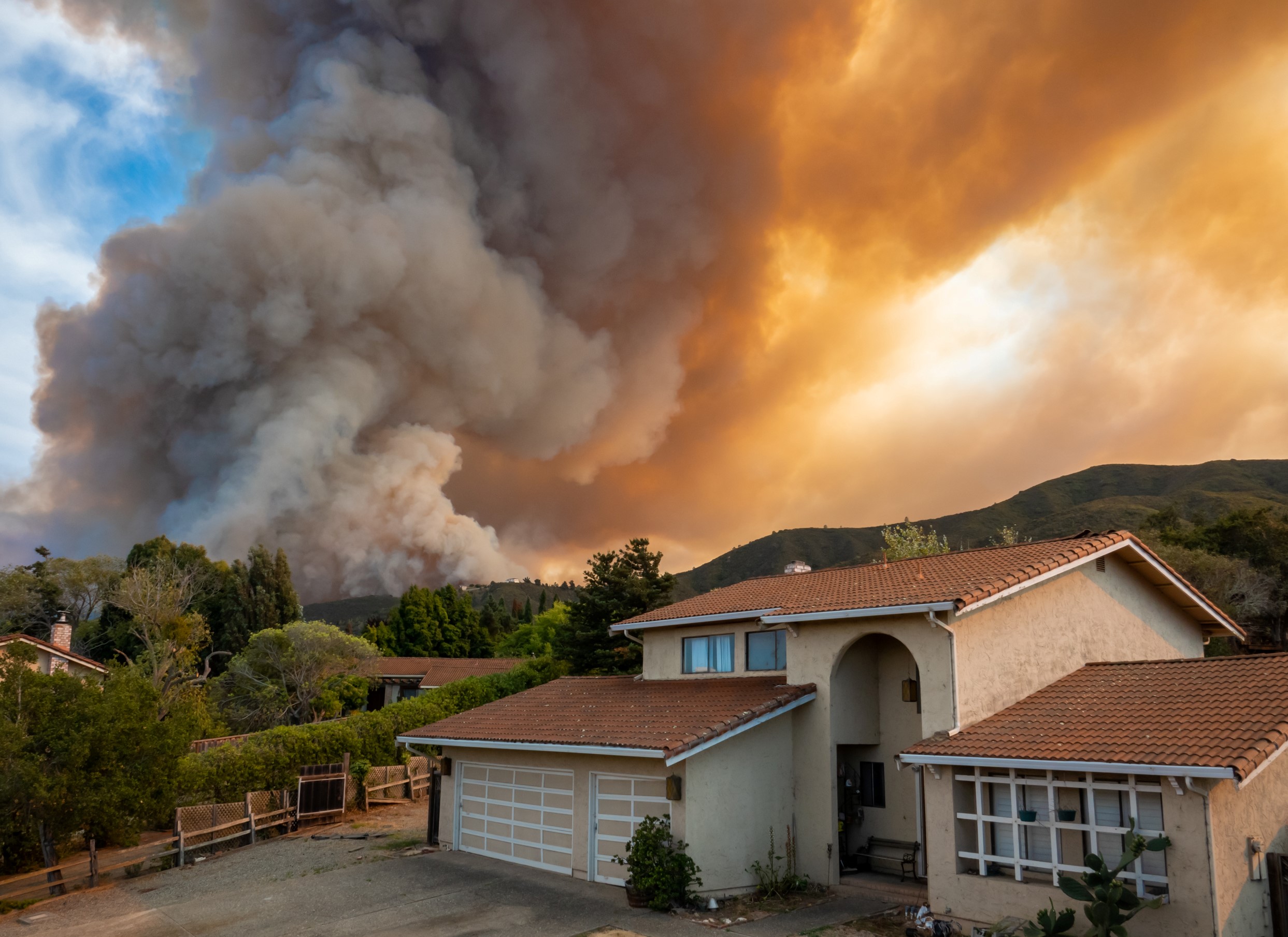
Disaster Resilience
We’re already experiencing the disastrous wildfires caused by climate change that scientists had predicted would not begin until the middle of the century. These wildfires look very different across our state, so we’re working to develop unique approaches that can work in both forest and chaparral environments. At the same time, we’re reconnecting floodplains to protect our communities from… [more info needed.]
By working at the intersection of science, conservation, policy, and economics, TNC develops and delivers solutions to increase disaster resilience and ensure that the protective benefits of nature can reach our communities.

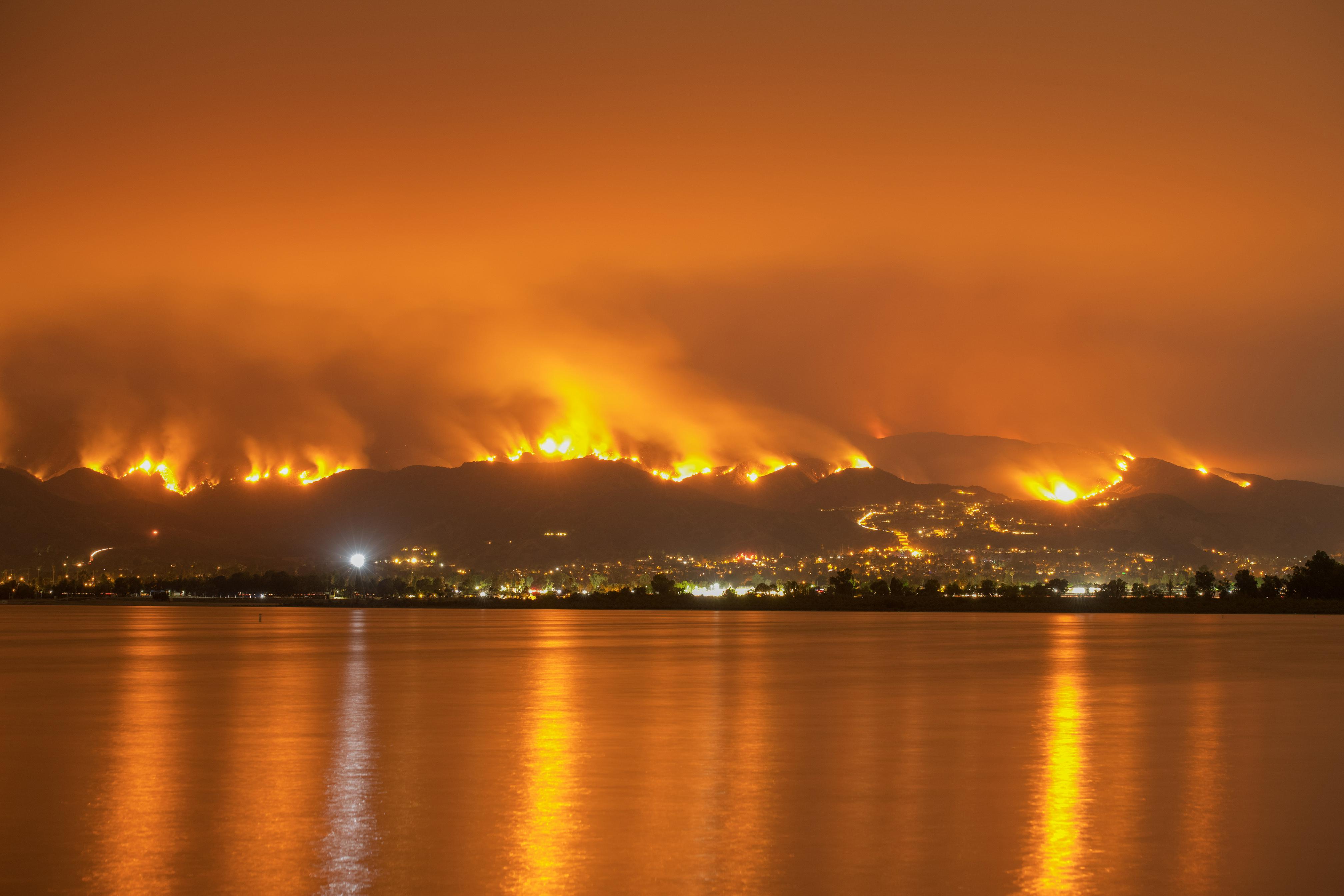
Forest Wildfire Resilience in Paradise, California
In 2018, the small town of Paradise, California, made international news when a wildfire killed eighty-six people, burned 95% of the town’s structures to the ground and caused billions of dollars in damage. The tragedy was of extraordinary proportions.
To learn from Paradise and help reduce the risk of it happening again, TNC launched two partnerships to develop and test new approaches to (re)development that combine internal and external expertise in fire and ecological science, conservation planning and economic modeling. Our 2022 report, Learning to Live with Fire in Forest Communities, highlights the science and benefits of fire-resilient community design.
CREATING WILDFIRE INSURANCE
The fire that destroyed Paradise resulted in $12.5 billion of insured property loss, and $16.5 billion in total property losses, making it the costliest single natural disaster in the world that year. So TNC partnered with insurance and risk management company Marsh McLennan to use catastrophe models to translate the modeled ignition risk reduction into terms used by insurers. This led to a new wildfire insurance policy that uses ecological forest management to reduce premiums. This can increase community safety, decrease costs associated with fire suppression and insured property losses, and improve the ecological health of surrounding wildlands.
A New Toolkit for Chaparral Wildfire
In 2025, devastating wildfires ravaged Southern California. These were chaparral fires, not forest fires, which burned across landscapes dominated by shrubs rather than trees. Under current extreme drought and wind conditions, exacerbated by climate change, these chaparral fires can result in explosive events that threaten our lives and communities. Recognizing the urgency of this threat, TNC is working with partners to develop tailored approaches to building wildfire resilience to combat these specific conditions. [More info needed.]
Reconnecting Floodplains
[More info needed.]
Quote: Laura Crane
The threats California faces are severe, but our state is also a place of extraordinary opportunity. From the willpower of our voters to the determination of organizations and agencies to the incredible power of our natural systems, I know we have the tools we need to keep our state safe.
TNC in California is working on all fronts and in all habitats to elevate nature’s role in the climate solution. Join us.
You may also like

Strategy Driven by Science
California voters are invested in building a safer, more climate-resilient future for our state. TNC has the scientific expertise and policy strategy to help achieve that vision.
Using Nature to Protect California’s Iconic Coast
With the Pacific Ocean projected to rise 5 feet in some coastal areas of California by 2100, we need to take action to protect the entire coast we love and depend on, whether developed or wild.