

Stephanie Kyriakakis
Conservation Scientist, Midwest
Grand Rapids, MI

Stephanie Kyriakakis Stephanie Kyriakakis is a Conservation Scientist for TNC in Michigan. © Matthew Mitchell Photography

Areas of Expertise
cartography, GIS, spatial analysis, coastal wetlands, Great Lakes
Biography
Stephanie joined The Nature Conservancy's Michigan Chapter in 2018 and transitioned to the Midwest Division in 2023. As a conservation scientist on the Midwest Division’s Strategy, Measures and Science Team, Stephanie conducts geospatial analyses at a division-wide level and helps bridge the gap between science and communications by creating compelling visualizations. She supports numerous conservation strategies for the division including the Northwoods, the Prairie-Woodland Network and coastal areas. Stephanie is also working on the Michigan the Beautiful Initiative in collaboration with the MI Department of Natural Resources and the Sault Ste Marie Tribe of Chippewa Indians as the ecosystem services project manager and one of the data/visualization specialists.
Stephanie served as the Blue Accounting coastal wetland visualization lead from 2018-2020 utilizing storytelling through mapmaking to advance coastal wetland conservation. She also served as a TNC Midwest Division Executive Committee member from 2019 to 2020.
Stephanie holds a Bachelor of Arts degree in Spanish with a minor in business from the University of Central Florida, an Master of Arts degree in international affairs from American University and an Master of Arts degree in natural resources and sustainable development from the U.N. Mandated University for Peace in Costa Rica. She also completed a practicum in Israel and Palestine during graduate school, which focused on water, cooperation and environmental peacebuilding. She speaks Spanish and is a certified Fire Fighter Type 2. In her free time, Stephanie is the captain of two ice hockey teams and loves to travel. She enjoys spending time outdoors with her daughter Georgie, wife Roxanne and their greyhound Leo.

May 2023
iNaturalist BioBlitz at Sharon Hollow: An Earth Day Celebration
In honor of Earth Day, citizen scientists gathered to collect observations of nature at the Nan Weston Nature Preserve at Sharon Hollow.
On Earth Day, I was supposed to drive to our Nan Weston Preserve at Sharon Hollow to lead a guided hike—with other staff members from The Nature Conservancy (TNC)—during our monthlong BioBlitz as part of Michigan State University’s 11th Annual Science Festival. However, Earth Day had other plans in store for my wife and I. Instead, we welcomed our first child Georgie Rose! On the other side of the state, TNC staff members led 30 people through April showers along the Sharon Hollow trail to the River Raisin for a morning of exploration and science.

Nan Weston Preserve at Sharon Hollow has over 260 species of wildflowers and other native plants. Spring is a wonderful time to explore the preserve since wildflowers are beginning to bloom, and the rainfall creates vernal pools (temporary pools of water) that provide habitat for insects, snakes and amphibians. It is also a good birding spot and provides nesting sites for the yellow warbler, rose-breasted grosbeak, barred owl and pileated woodpecker.

On our BioBlitz hike, the group logged 166 observations of 59 species including eastern skunk cabbage, large white trilliums, Dutchman’s breeches, bloodroot and a wood frog. Overall, throughout the month of the BioBlitz, we received 284 observations that included 106 species!

Thank you to everyone who participated in this year’s BioBlitz, as well as everyone who has submitted observations on TNC preserves through iNaturalist. Every observation helps!
Get Involved
If you missed this year’s BioBlitz, it’s not too late to join the fun and get involved on iNaturalist!
What is a BioBlitz?
A BioBlitz is a citizen-science effort to document as many species as possible within a specific timeframe and area. Members of the public visit participating parks and preserves while using the iNaturalist app to log the plants, animals, fungi and other organisms they find. It’s a great opportunity to get outside and enjoy nature while contributing to scientific understanding.
What is iNaturalist?
iNaturalist is an online platform that uses crowdsourcing to identify species and how common they are in a particular place. One of the many great aspects of iNaturalist is that you do not need to know the species to log an observation. Other users will help identify the species as a community—once two out of three people agree on a species, the observation is designated “research grade.”
TNC has 18 of our Michigan preserves on iNaturalist. So far, 358 total observers have logged 3,570 observations at these places, representing 1,178 species. Our staff regularly review submissions to help identify observations. Your discoveries help us better understand what species use our preserves and how our restoration efforts contribute to healthy ecosystems.
How can I get started?
We hope you will consider downloading the iNaturalist app and logging a few species the next time you explore a TNC preserve! Nan Weston Preserve at Sharon Hollow is a great option for your first visit. Check out our preserve page for more information on Nan Weston Preserve at Sharon Hollow to plan your next hike!
How to record an observation on the iNaturalist app:
1. Select the observe button
2. Upload or take a photo of the species of interest
3. Click the “What did you see?” button to select the species, or use a suggested species
4. Share your observation

Good luck out there—I can't wait to see what you find!
November 2022
Planning for People and Nature: Selecting socioeconomic indicators for our conservation programs
A team of scientists at The Nature Conservancy (TNC) is using data to connect people to nature and science. Learn how they selected social and economic indicators for coastal conservation to track progress toward our conservation goals in Michigan.
The Connection
Part of my job as a conservation scientist with TNC is to use data and information to address conservation challenges. To improve coastal conservation decisions in the Great Lakes, I work with the TNC Michigan science team to identify and fill science and data gaps. For example, to measure progress in coastal wetland conservation, we have compiled data such as total acres of wetlands protected and total dollars invested in wetland restoration. But to achieve our vision of a future where both people and nature thrive, how should we track progress for people?
The science team wanted to identify social and economic indicators for coastal conservation that our team could use to track progress toward our conservation goals. We put together a coastal wetlands team composed of TNC scientists specializing in Great Lakes coastal wetlands and geospatial science. Our coastal wetlands team was advised by the Great Lakes Coastal Assembly—“a diverse group of over 20 federal, state, and interstate agencies, tribal governments, NGOs, and universities working together to conserve the land-water interface in the critically important coastal zones of the Great Lakes.”
To achieve our vision of a future where both people and nature thrive, how should we track progress for people?
Identifying indicators, particularly socioeconomic indicators, can be challenging because the selection process can be time-consuming. Generating data for the indicators can also be costly and require extensive monitoring. However, socioeconomic indicators would help create connections between ecological goals and the outcomes that Great Lakes coastal communities care about such as enhanced social and economic benefits. Demonstrating the connection between coastal wetland conservation and human well-being helps fulfill TNC’s vision—“a world where the diversity of life thrives, and people act to conserve nature for its own sake and its ability to fulfill our needs.”
TNC enlisted the inaugural Bailey Conservation Fellow, Mauri Liberati, to help develop and implement an indicator selection process that would address these challenges. She used human quality of life frameworks to identify socioeconomic indicators, paired with structured decision making for facilitating the selection process. The coastal wetlands team also collaborated on this work with two additional Michigan conservation programs to leverage our collective insights. We worked with team members from agriculture (adoption of ag soil health and nutrient practices in the Saginaw Bay watershed) and urban water (implementing green stormwater infrastructure in the city of Detroit).
This indicator selection process had four steps: Brainstorming, scoring, winnowing and implementation.

Socioeconomic indicator selection process pilot program areas and land cover types— Agriculture, Great Lakes coastal wetlands, and Urban water. The main map displays a hillshade representation of ground surface height (light green equals lower elevation, dark green equals higher elevation. Data Sources: 2019 National Land Cover Database; (Homer et al., 2020), Airbus, USGS, NGA, NASA, CGIAR, NLS, OS, NMA, Geodatastyrelsen, GSA, GSI, GIS User Community and the U.S. Census Bureau
Step 1: Brainstorming the Socioeconomic Indicators
The coastal wetlands team started this work by participating in an indicator brainstorming phase. During this phase, we developed a comprehensive list of all potential socioeconomic indicators that aligned with TNC’s human well-being focal areas—living standards, health, education, work and leisure, governance, social cohesion, security and equity. All three conservation programs collaborated on this phase, and we received valuable input from TNC staff from our development, communications and operations departments.
Mauri then compiled our list of socioeconomic indicators from the brainstorming phase with both the agriculture and urban water teams. All together, our three teams identified 278 potential socioeconomic indicators. From this list, 52 of those indicators overlapped between the three teams and were particularly valuable to explore further. An additional 26 indicators that individual programs considered to be of high importance by the three conservation programs were also advanced for additional evaluation. In the end, 78 socioeconomic indicators advanced to the next step.


Step 2: Scoring the Indicators
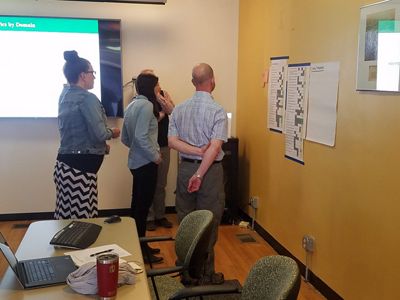
The next phase consisted of our coastal wetlands team assessing the 78 indicators identified during brainstorming. We evaluated the indicators by scoring them on six criteria:
- Relevance to TNC Michigan’s conservation strategies
- Resonance to the community
- Responsiveness to conservation project impact
- How realistic it was to obtain the necessary data or carry out the needed monitoring efforts
- Data availability
- Confidence to capture team scoring alignment
The last two criteria–data availability and confidence–were added after Mauri recognized during group discussions that those were important aspects of the indicators that our team was grappling with.

Step 3: Winnowing
During the winnowing phase, the coastal wetlands team had to consider our priorities. For indicator selection, prioritization means specifying which criteria are more or less important for a given scenario. There may be scenarios where relevance to communities is by far the most important criteria, another scenario where data availability is the most important criteria, and another scenario where those criteria are equally important.
We started this step by specifying three scenarios that were important to our team. The first, wetland optimization, would focus on determining where we prioritize coastal wetland conservation and restoration work. The second scenario, capacity to monitor, determines where coastal wetland monitoring efforts would be most meaningful. And the third, research needs, would determine what indicators would serve best as future research topics for our science team. Within each scenario, we indicated the relative priority, or weights, of the five criteria from our scoring step.
The criteria scores (Step 2) and criteria priorities (Step 3) were combined to calculate an overall score for the 78 socioeconomic indicators we were considering.

Despite the diversity of the work across our three programs, the top-ranked indicators were all related to flood risk and damage. Only a quarter of the indicators were ranked in any team’s list of top-five indicators, showing further commonalities across our programs.
Step 4: Implementation
This structured decision-making framework helped us identify property damage from floods and storms as a high-priority research need in Michigan. The science team is now working with Michigan Tech Research Institute and the University of Michigan to quantify the relationship between coastal wetlands and flood mitigation. Our science team also looks forward to using this framework in an upcoming project to select social and economic indicators for a statewide conservation prioritization strategy.
We also implemented this indicator selection process with a group of stakeholders from the Great Lakes Coastal Assembly, a volunteer-based group composed of binational federal, state non-profit and tribal members who work on Great Lakes coastal wetland issues. The Coastal Assembly adapted the framework that Mauri and the TNC team developed to make it relevant to issues across the Great Lakes Basin. The Coastal Assembly used the same process but developed their own scenarios and prioritizations to evaluate the socioeconomic indicators. And again, despite our program differences, indicators related to property damage from floods and storms were considered particularly important.
You can check out the full article, Planning for People and Nature (Liberati et al., 2022) in the Journal for Conservation Science and Practice. It is exciting to participate in an effort to further connect people to nature through science and data. We hope other conservation entities find this structured decision framework helpful to inform their socioeconomic indicator selection process and better integrate socioeconomic indicators into Great Lakes decision making.
Jurjonas, M., May, C. A., Cardinale, B. J., Kyriakakis, S., Pearsall, D., & Doran, P. (2022). A Synthesis of the Great Lakes Restoration Initiative According to the Open Standards for the Practice of Conservation. Journal of Great Lakes Research. https://doi.org/10.1016/j.jglr.2022.01.008
Liberati, M. R., May, C. A., Sowa, S. P., Kyriakakis, S. R., Pearsall, D. R., & Doran, P. J. (2022). Planning for people and nature: Comparing quality-of-life outcomes across environmental systems to inform conservation planning. Conservation Science and Practice, e12782. https://doi.org/10.1111/csp2.12782
Jurjonas, M., May, C., Cardinale, B., Kyriakakis, S., Pearsall, D., and Doran, P. (2022). The Perceived Ecological and Human Wellbeing Benefits of Restoration. People and Nature. In review (Oct).